The unstoppable march of tech continues, and today sees the launch of FATMAP – a smartphone app that provides detailed 3D maps of more than 25 major resorts across North America and Europe.
If you’ve ever tackled a resort with a ‘hit and hope’ philosophy, only to find yourself stuck in the wrong valley or picking your way down a gnarly mogul field, then this could come in handy. Obviously it’s no substitute for local advice and professional guiding – which remain essential when heading to the backcountry – but it’s certainly a step up from folded paper piste maps and contour maps.
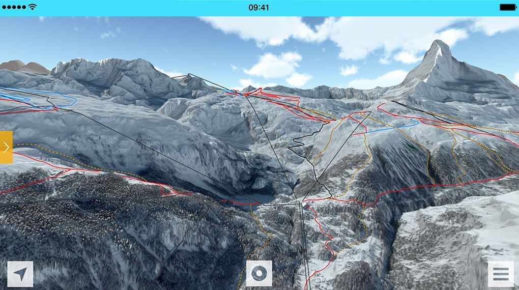
The terrain is satellite-mapped to within two metres of accuracy, with all trails clearly marked and graded by difficulty. The most popular resorts in France, USA, Canada, Austria and beyond are currently covered, with more on the way – and if you’re worried about expensive roaming charges, all maps can be downloaded to your phone to use offline.
The app uses your phone’s GPS to show you where you are at all times, so if you want to get really stat-happy then you’ll get a full breakdown of your speed, distance and descent. The developers have mined local knowledge to provide reviews of everything from runs to restaurants, and you can add your own verdicts too.
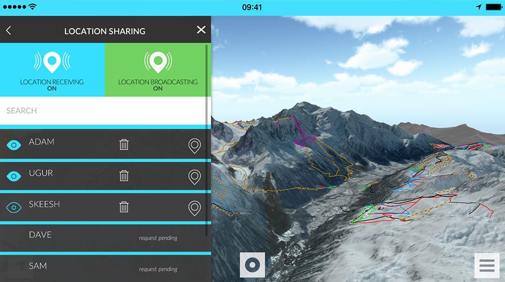
Another feature is the ‘Terrain Intelligence’, which uses input from trusted locals to fill you in on a zone’s gradient and aspect, as well as providing additional info about avalanche risks and crevasses. Again, guiding is a must, but with this you can study the mountain to your heart’s content before venturing out, or review your route afterwards.
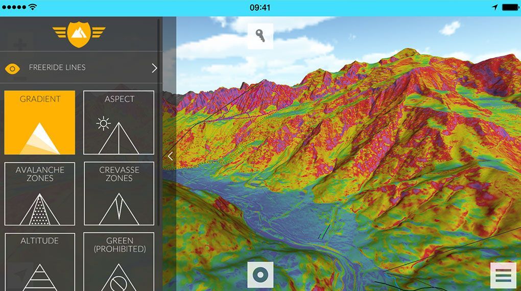
FATMAP is now available from both the App Store and Google Play. Download the free version, or go premium for either two weeks or a full year:
Two-week: £9.99 / €12,99 / 13CHF / $12.99 / $14.99 CAD
Annual: £25.99 / €34.99 / 34CHF /$34.99 / $39.99 CAD
What do you think? Leave your comments below, and head to the FATMAP website for more info.

